Saturday, August 7, 2010

Trip Report: Other Adventures in the Red Rocks

In addition to the recent posts on hiking in the Grand Canyon and hiking through Oak Creek Canyon in Sedona, I went hiking in a few other places while visiting Arizona.  Here, I will summarize the final four destinations, in the following order:
  • The House (some nice views)
  • The Vortex, and the Other Hill (ooo, mystical)
  • Cathedral Rock (huge, beautiful rock formation, and danger with lightning)
  • Devil's Bridge (walk over it... if you feel lucky)
Skip ahead to whatever interests you.

The House

We stayed with my grandparents at their rented house in Sedona.  Here are some of the views we woke up to in the morning:


Here are some of the views at night:


Here's me and my parents, with the view from the porch:


And the house itself:


It was a beautiful place to stay, situated right next to one of Sedona's mystical vortices!

The Vortex, and the Other Hill

Sedona has "vortices," or areas of unexplained mystical energy.  Sedona's a bit new-agey that way.  People like to hike out to the vortices, sit down and meditate, stack little piles of red rocks, play their drums or flute, etc.

(Many people in Sedona say "vortexes."  Apparently, both pluralizations are acceptable, so I'll go with the one that sounds better to me.  After being raised by a math prof and hearing about vertices my whole life, words like "vortexes" just make me wince.  I like cacti and matrices and Elvi.)

As it turns out, our beautiful home was right next to one of the four vortices!  At all times, people could be seen on the vortex.  Here's an example of a typical vortex sunset crowd looked like, from the porch of our house:


Ants on a hill.

My grandparents reported seeing many strange people up there, including a man dressed in a bright white cowboy uniform.  Meanwhile, the hill right next to the vortex was consistently deserted!  Poor, unloved hill.  We decided to take a hike over to the unloved hill, and then to the vortex itself.

Here is a picture of Dad on the top of the unloved hill:


The views from the unloved hill were just as nice as those from the vortex.  We could see some nice red rock formations:


The valley below:


And "Bell Rock," which Dad and I both agreed looked more like a giant breast than a bell:


I think we all liked the unloved hill more than the vortex hill.  More solitude.  I made my own mystical rock pile on the unloved hill:


From there, we moved on to the vortex.  There were two couples sitting on top of the vortex when we visited.  Both were silent, lost in contemplation or absorbing the energy.  I wanted to take a picture of me and Dad meditating at the vortex, but when looking around for Mom, who had the camera, we found that she had set off for a three mile hike.  No pictures for us.  Perhaps the vortex didn't want pictures of it taken... Perhaps it sensed our cynicism and repelled us... mysterious.

Cathedral Rock

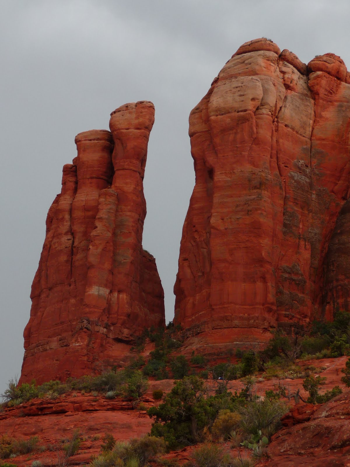
It turns out that Cathedral Rock, one of our hiking destinations, is also a "vortex."  I get the feeling that people have confused the terms "pretty place" and "vortex," but the hike was nice.

We set out amid distant rolls of thunder.  Here are my parents, posing with Cathedral Rock and ominous clouds in the background:


Here's the rock again, this time in desktop photo format for your convenience! :)


As we continued upward, the thunder seemed to be approaching.  We repeatedly wondered whether the correct response was to climb to the top of the highest thing we could find, but we decided to push ahead anyway. 

Along the climb, we encountered flora such as my favorite thistle:


Mom's favorite dead tree:


And many prickly pears.  (Don't pick a prickly pear by the paw, when you pick a pear, try to use the claw!)


If you're into prickly pear, here's a prickly photo for your desktop!


The thunder continued to worsen, and we saw rain clouds consuming rock formations in the distance:


Still, none of us were more than vaguely worried, so we continued up the path, which began to get steeper:


We eventually came to the first great overlook, I mean, vortex!


From here, we ascended further to the second and final great viewpoint.  Looking down into the valley, we could see the river where our trail began:


Here, Mom points to a small pile of mystical vortex rocks in a dangerous location near a drop-off.  Someone may have risked their lives to bring you that pile of rocks.


Also at the top was a crack in the rock that very much wanted to be climbed... just look at it...


Time for a RED ROCK MONTAGE!


Montage end.  (If you liked that, check out my Arizona screensaver!)

Last up, and most dangerously, is...

Devil's Bridge

I want to avoid writing too much about this, because my photos of the location are on Mom's camera, which is back in Oregon.  I'll be there in a little over a week, at which point I can write about this hike in more detail.  It was a hike combining hilarity (we took a completely wrong route to the bridge, and the names of surrounding landmarks sounded like they came out of The Lost Skeleton of Cadavra) and terror.

I will note, briefly, the "terror" section of the hike.  Devil's Bridge is a landmark for people who feel lucky.  It is a natural bridge of rock that could go tumbling down at any moment.  Kids love to run across it while saying, "Look, Mom, it's totally safe" and giving their parents heart attacks. 


We spent this section of the trip in a state of worry that we'd see someone die.  Close your eyes and concentrate for a moment.  Try to get yourself into that mindset.  And then, watch these videos I found on youtube: cartwheel and dance!

Really, between this and the tourists trying to take Grand Canyon photos as close to the rim as possible, I'm surprised we didn't see any close calls.  Wait a couple weeks and you'll be able to see photos of me and Dad tempting fate...

Closing Note

Writing this post has made me nostalgic.  It's been two weeks since I was in Sedona, and I wish I were there again.  The company and the scenery were excellent.  It's been a little over a year since I last fell in love with a location (the last time being Mt. Adams, WA), but these sorts of trips remind me why I love hiking and the outdoors.  Everywhere you turn in Sedona, it's unbelievably beautiful.  In Sedona-speak, must be the vortices!

Sunday, August 1, 2010

Trip Report: Hiking in the Grand Canyon

A week ago, I returned from my Arizona trip.  I was busy that weekend, so I wrote about jerky (I tried the ostrich today; it was pretty good).  Now, I'm spending a relaxing evening at home and can write about the most epic part of the Arizona trip: the Grand Canyon.


On the first day, Mom, Dad, and I went for a walk along the rim.  We observed the canyon's bigness  ("Is your canyon grand enough for you, Mr. Bond?").  Here are Mom and Dad posing at one of the many places you could fall to your deaths, trying to imitate the cute little heart sign that some of the Japanese tourists were making:


Here are some tourists posing at another place to fall into the canyon:


It's fun to run your finger along the picture, like you're pushing the tourists over the ledge, while making a video game sound effect.  Or maybe that's just me.

Anyway, the Grand Canyon is really big.  I had trouble grasping the real size of it from the rim, though.  The canyon barely looks real from the rim.  It looks like you're viewing a huge panoramic photograph, but it's hard to comprehend distances.  I wanted to walk down into the canyon in order to get a better idea of the size of the place.

Thus, a plan was formed to hike into the sweltering July canyon, from the rim down to a viewpoint we could see far below.  You can see the trail going out to the viewpoint here:


The hike down to the point and back to the rim (a combination of Bright Angel and Plateau Point trails) was rumored to be a little over 12 miles round trip, with a little over 3000 feet of elevation gain.  A great hike in normal weather, but the Grand Canyon gets hot in July.  It hangs around the mid-80s at the rim, but as you descend, it gets hotter.  (The warmer temperatures in the canyon are likely due to elevation change and shelter to wind, but I'm just guessing.)  Down at the viewpoint, the weather gets into the mid- to high-90s, and at the bottom of the canyon by the banks of the Colorado River, it regularly gets to 105 and even 110.

The plan, then, was to get down to the viewpoint as early as possible, and try to get back to the rim before noon.  Given that the estimated hike length was 8-12 hours, we started out early, hitting the trailhead at 4:50am.  The sun rises at 5:21...so yeah, here's the trailhead:


Ahh, the beauty of the canyon.

Having no flashlights, we couldn't have left any earlier, so we felt good about our starting time.  We set a hard turnaround time of 7am so we wouldn't be stuck in the canyon in the heat, giving us just over 2 hours to reach the viewpoint.  This seemed a bit ambitious, given the estimated 8-12 hour hike time, and that 7am turnaround time was always on our minds.  The weather was already in the 70s when we started out.  Moving at a quick pace, we passed numerous hiking parties with headlamps.  When they asked what the hurry was, we gave them a quick answer ("Trying to reach the point before 7!") without pausing to chat.

It started to get light.


Did I mention we were in a hurry?  I paused to take a picture of a deer, and Mom and Dad just continued on at their quick pace.  By the time I put the camera away, I had to jog down past a couple of bends in the trail before I caught up with them.


Here are my parents on the trail, which has a lot of steps carved into it:


The path ahead:


Soon, the sun started to chase us into the canyon:


As the slope leveled out, we approached a river.  The river led to increased vegetation in an area called "Indian Garden."  You can start seeing the vegetation here:


Unfortunately, we have no pictures of Indian Garden in all its cactus-filled glory, because at this point we looked at our watches (25 minutes until 7am!) and the "3.1 miles to plateau" signpost, and we actually started jogging towards the destination.  82 degrees now, said the thermometer at Indian Garden.

When I paused to apply sunscreen, Dad pressed on towards the point, and I had to jog for a good 5 minutes before catching up to him.  Yes, it was fun going jogging through in the Grand Canyon after passing so many signs on the way down that warned of heat stroke, dehydration, and the importance of taking frequent rest breaks. :-)

The next photo I got from the camera was our triumphant group shortly after 7am, at Plateau Point!


Behold, the beautiful talus back the way we came!


We found the Colorado River, which carves its way down the middle of the canyon!


We also noticed the trail that leads down to Phantom Ranch, the famous ranch down by the river where people stay overnight.  You can see it here:


We took a final look at the beautiful Grand Canyon from the inside...


...and then, having spent a whole 10 minutes there, we turned around again and started our return hike, racing the heat!

A bit later, looking back towards the point, you could again see some of the vegetation around the Indian Garden area:


The return trip featured:

Scenery!


Wildlife!


Aww, that squirrel has light dots on its fur.

Let's talk about squirrels. 

Grand Canyon squirrels are extremely aggressive.  I've had a wild ground squirrel climb onto my shoulder to get peanuts before, and those guys are scaredy-cats by Grand Canyon standards.  Grand Canyon squirrels charge tourists, making screaming noises if other squirrels get in their way, and don't think twice about getting close enough to get kicked.  If you upended a bag of peanuts on your head, you'd get swarmed.

Enough about squirrels.

Mom, Dad, and I were hiking upwards at different speeds, and eventually got separated.  Mom was pretty fatigued, and it turned out that she only drank about 1 liter of water during the ascent because she didn't feel thirsty and didn't realize how little she was drinking.  For comparison, I drank 3.  She was probably on the verge of getting heat stroke.  Passerby would ask her if she was okay, and if she had water, and she would say that yes, she had water.  Of course, they never asked if she had been drinking it...

Even with all of this, Mom arrived at the trailhead again at 11:20am, making the round trip in 6.5 hours.  I took about 6 hours, and Dad took about 5.5 hours.  Dad's prize was getting to shower in the hotel room before we had to check out, but Mom and I didn't arrive at the top early enough.  Still, the estimated hike time given on signs was 8-12 hours, so we did pretty well.

Near the top, I got some other hikers to take my picture.  The guy photographing me was pretty funny.  He took one picture, portrait-style, and said, "Your boyfriend will like that one.  Hold on, let me take one for mom."  Then he turned the camera to landscape orientation to take another one.  I'm still trying to figure out what was up with that, but it was pretty funny.  He also gave me a peppermint candy, which tasted excellent and got me through the last 10 minutes of the hike.

So, this picture is for Ken:


And this one is for Mom!


Hello from the Grand Canyon! :-)

Also, do you remember two weeks ago when I made you a desktop background?  Go back and check the blog.  Well, now I made you a screensaver of cactus and rock pictures I took!  Here it is, just for you:

http://web.mit.edu/joyp/Public/ArizonaScreensaver.zip