Thursday, September 23, 2010

Trip Report: Acadia National Park, Day 2

Welcome back to the exciting conclusion of the coverage of my trip to Acadia National Park!  Beth reminded me that I had failed to mention that we became boy scouts, so I'll start by explaining how that happened.  Then I will talk about the coast and then about the bubble and the lake.  And, as promised, the dramatic ending will be a new desktop photo!


Topic 1: We are now boy scouts.

Our campsite had a fire ring.  On the first night, we had a bundle of logs and some papers we found sitting around the backseat of Beth's car.  We tried to make a fire.

It took us three tries to get a fire burning.  On the first try, we used paper and no kindling.  The second try, we used paper and a handful of damp twigs.  On the third try, we spent about 20 minutes peeling bark off the logs to make kindling, and were finally successful.

Night 1 was kind of pathetic that way.  Now, we watch our progression to becoming boy scouts:

On night 2, we actually had some kindling, and we lit the fire on the first try.  Then we went to hear a park ranger give a talk, and when we returned, we lit the fire using only the old embers from the previous fire!  We figured this pretty much made us boy scouts.  I can even tie a figure 8 knot, and a fisherman's.

Topic 2: The Coast

Acadia is known for its coastlines.  I think we were too busy exploring, because we don't have many pictures.  There are lots of fun rocks to explore.


There are also many coastal birds.  Ever since my friend Larissa pointed it out to me, their shape reminds me of footballs waiting to be kicked:


So...that's about it for coastal photos.  We had a lot of fun climbing around, though.


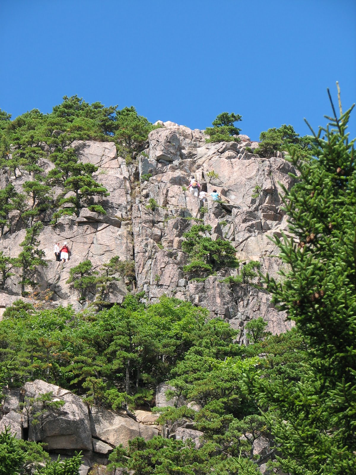
Topic 3: The Lake and the Bubble.

Our hike for the second day took us up the "South Bubble," a majestic peak rising to a height of 768 feet above sea level!


Its sister "mountain," spotted across the way, was not doing much better, height-wise:


The reason that so many people hike up South Bubble is to try their strength against a "glacial erratic" (a rock deposited in a funny place by an old glacier).  I gave it my best:


I couldn't get the rock to go over the side.  Beth and I tried together:


We couldn't get it to go over the side.  You may ask, "Why even try?!?!"  Well, first, the park ranger the previous night told us to.  Second, it's like gambling!  It will probably go over the side eventually, so the only question that remains is, how unlucky are you?  Turns out, Beth and I are both lucky!  It's good to know!

From the summit of South Bubble, we hiked down to a nice lake.


The hike around the lake was really nice.

Almost a bit too nice, actually.  Acadia, being a National Park, has parts of it that are somewhat resort-y.  Halfway around the lake, we came across and outdoor restaurant on a lawn.  We picked up some sodas and used the restrooms before continuing on.  In fact, I think I went the entire 3-day camping trip without using anything but a flush toilet.  It almost doesn't count...

Here is another view of the beautiful lake we walked around:


From a little further (clockwise) around the lake, the two "bubble" mountains you can see in the distance looked a lot like breasts.  You may remember the last breast-shaped rock formation featured on this blog, from this post...

Here's another nice view of the water:


Time for some miscellaneous nature photos.  The dregs!  These are two trees that wound their way around each other in a confusing way.  What exactly happened here?  Did someone tie them in a knot as saplings?


Finally, here is a mushroom montage:


The last mushrooms in the montage are...


Topic 4. Your new desktop photos!

Choose one, and click for a large version.  I think my preference is for the second one.


Sunday, September 19, 2010

Trip Report: Acadia National Park, Day 1

(A quick note before we beginI just looked back over last week's post.  How can you not think those photos are awesome?  I felt kind of guilty about my indulgent mountain photo post, but in retrospect, I think the photos are beautiful.  Perhaps I should indulge myself more frequently.)

The week before my classes started, Beth and I went on one final summer trip.  We decided that, despite the 6 hour commute it entails, we would go to Acadia National Park.  We'd both been meaning to go there for a while.


Acadia is a national park on the Maine coast, and while it is fairly small, it has many trails that span mountaintops, lakes, and shorelines.  I'm using "mountaintops" in a different way than I was in last week's blog post, of course -- different by about 12,000 feet -- but I'm starting to like the hills of the East Coast.  They have their own charm about them.

As a matter of fact, standing on top of a peak in Acadia, I remember looking over at a neighboring peak and thinking, "Look, a pretty East Coast mountain" instead of "Wow, that is pathetically tiny."  This struck me as novel at the time.  ...But I actually mean this as a compliment.  I'm starting to like the wilderness out here.  Really!


On the first full day in Acadia, Beth and I hiked the "Precipice Trail."  Why is it called the Precipice Trail?  Well, here's a picture of me hiking on the trail...


That is literally the trail.  And yes, that is a cliff next to me.  My left hand is holding onto the rock for a reason.  Fortunately, by the time my parents read this and get worried about the trail, they will have the comfort of knowing that I made it through without ...mishap.


Other areas of the trail had railings:


The proximity of the cliffs wasn't the only strange part of the trail.  The trail was, in general, a bit weird.  For example, spot the trail in this photo:


Yep, those boulders are the trail.  Ok, spot the trail in this photo:


This, too, was part of the trail:


Yeah, that's a very steep trail.  Acadia is known for having a couple of trails that you have to climb on iron rungs.  Here is Beth's foot and the view back down one section of the "trail:"


Some other steep sections of the trail:


Here's a view back down to the parking lot, giving an idea of the steepness of the grade:


And here's a view of the cliff face "trail" (The Beehive) that we descended:


We came to the top of the Precipice Trail.  The summit had these little lakes that seem to exist on the summits of many East Coast peaks.


A bird cheated by flying, and it met us up there.


There were also some interesting markings on the summit.  10 points to the first person to tell me what caused them (or to state, with certainty, that some of them were caused by glaciers dragging rocks along the peak).


We made our way down to a lake.


Here, we captured a new desktop photo for you!  So take down that old one from Sedona, click on this for the full version, and enjoy! :-)


ribbit.

We continued through the woods...


...down the Beehive Trail (really, this is only barely a trail)...


...and along a beach of which we have no photos.  Then we walked along a road that wound through oaks.  We spent about a half hour trying to figure out exactly what type of oak trees they were, using my handy plant-identification guide that I'd bought before the hike.  We narrowed it down to two, but now I forget which two they were.

We finished the hike with a view back to the original Precipice Trail, over a pond and some reeds.  Something about this view reminds me of Black Butte, in Oregon.


That was all the hiking for day 1, though we did go check out the whale museum in the town.  It featured baleen, a huge, whale jaw, and a whale movie narrated by Patrick Stewart.

Next week, I will write about the second day of our Acadia trip, which featured the rocky coastline and a beautiful lake!  There will also be another brand-new desktop photo, if that's the sort of thing that motivates you to come back and read more.

See you next week!

Sunday, September 12, 2010

Indulgent Mountaineering Photo Post

A couple weeks ago, looking for photos of Mt. Rainier, I stumbled across some amazing photos of crevasses, ice formations, wind-swept landscapes, and steep slopes.  I know I am more interested in mountaineering than most people reading this, and that I already posted about Mt. Rainier twice, but I'm going to be self-indulgent and post about Mt. Rainier again!  Partially because I might climb Mt. Rainier someday, so I am even more interested in these photos than usual. 

All photos here are from the area between Camp Muir, which is at 10,080 feet, and the summit of Mt. Rainier at 14,411 feet.  Hope you enjoy them.

Due to needing to cite the sources for all the images, I'm going to organize the images by whose flickr account I'm taking them from...first up, cdine!  The following images come from cdine's flickr photostream.

Here are some photos of hiking at high elevation.  The photos remind me of skiing.


Here is the summit!


And here are some huge crevasses.  Very dangerous!


I love the pictures above the clouds.  Pretty good, cdine!  Now it's simonov's turn.  These are from simonov's flickr photostream.  Simonov has lots of photos:


Here is a photo of the Ingraham Flats camp from above.  Take a look at where the tents are positioned, right above a glacier that is tumbling down the mountain.  It's like the tents are about to go down the mountain on a huge glacier slide.


Here is a photo from the top of "Disappointment Cleaver."  Great name.


And here are some trails up the steep glaciers above 13,000 feet.


Thanks, simonov.  Next up is leodirac!  I'm only posting one photo from leodirac's flickr photostream, and here it is:


That's the trail, going right along the side of a crevasse.  Very dangerous!  That's why there's a fixed line to clip onto.

Next up is a picture from Walter Siegmund via the Wikimedia Commons, of the Emmons Flats camp.  The Emmons Flats camp is yet another camp that looks like it's about to fall into a crevasse:


Finally, here are some photos from bigyahu's flickr photostream.  This one might be my favorite:


I like this one a lot, but probably just because I love the color blue.  I think this photo is from Camp Muir, where I hiked up to a couple weeks ago.  In the distance, you can make out Mount Adams.  If I look at this photo at full resolution, the loneliness of it is beautiful.  I sort of imagine putting my skis on and taking off down the slope.


Camp Muir in the dark:


And finally, here's a photo of the place I ate lunch when I hiked to Camp Muir, but with a completely different character in the blue light:


For comparison, here I am at that location in the daytime:


One last photo from simonov, taken from lower down on the mountain.