

is possibly

the most beautiful

of the Cascade volcanoes.

Cole and I hiked halfway up Mt. Rainier to a place called Camp Muir about a week and a half ago. Today I will attempt and fail to fully describe the mountain's awesomeness!
First Half: Below the Timberline
The hike starts off in the trees, with other mountains as a backdrop. The other mountains are placed almost like foothills south of Mt. Rainier, but they have glaciers on them and look like mountains in their own right.

You can't tell in the photo above, but all that greenery below the trees is full of wildflowers:


There are little alpine streams everywhere. (This one is for Yuki, who is in love with little streams!)

I had seen many photos of Mt. Rainier that have the mountain rising above a grassy meadow full of wildflowers and a little stream, and I had always assumed that professional photographers had to go out of their way to find that one perfect shot. But no, that perfect shot exists everywhere. Here's my version, though you can't quite make out all the wildflowers that exist in the foreground:

Just look at the shape of that mountain. Beautiful.
An added bonus is the existence of marmots! They were in snacking mode when we encountered them. Marmots hibernate in the winter, so they need to eat as many lupins as marmotly possible during the summer months. We saw four marmots, and all looked kind of chubby. A couple of them were completely unconcerned about our approach, not looking up at us even though we were about 5 feet away on the trail. Here is a fearless marmot chomping the head off of a lupin:

cutecutecute
A couple other Cascade volcanoes could be seen through the smog from Seattle. Here is Mount St. Helens, of 1980 eruption fame:

And here is Mount Adams, which Cole and I climbed last summer:

Second Half: On the Glaciers
Eventually, the greenery gave way to glaciers. Most of the rest of the hike looked like this:

Glacier hiking is a wonderful thing. You get into a zone. In the zone, you keep putting one foot in front of another as you climb a long white staircase. The scenery changes slowly as you ascend, but you spend most of the time looking down at the next place to place your foot. You lose track of time, get lost in your thoughts, and listen to a catchy song loop in your head. From time to time, you look up the glacier and back down where you came from, and you realize that you've made significant progress.
Times like these may call for overly-epic water breaks.

I love glacier hiking. Reaching your destination after a few hours in the glacier-hiking zone is a rewarding experience, one which increases respect for or closeness with the mountain. Or something. Perhaps what I'm trying to say is this. Anyway, it is part of why I like climbing.
As we hiked onward, we got excellent views of crevasses:


There was also a waterfall coming from one of the glaciers:

Our hike took us onto some talus fields, where a few small plants grew.

Some hardy glacier bees could be seen nearby:

Here is a view of one of the talus slopes that we climbed up after a couple hours of glacier hiking:

Destination: Camp Muir
At last, after four hours of hiking (we left around 10, arrived at the camp around 2), we arrived at Camp Muir. It's pronounced Myoor. Camp Muir is the base camp for most climbers attempting to summit Mt. Rainier. For reference, the trailhead at Paradise Lodge is at 5,400 feet, the summit is at 14,411 feet, and Camp Muir is at 10,080 feet.
Camp Muir has a few small buildings for rangers and guided tour supplies, and some outhouses. There is a small shelter with bunk beds for the climbers who arrive early enough to claim them.


Camp Muir is also the furthest you can hike before the going gets technical. Beyond the camp, climbers need to rope up, because crevasses start to appear. Here is a photo taken from our lunch spot of the crevasses that start immediately following Camp Muir:

Climbers had set up camp on the glacier immediately beyond Camp Muir:


Beyond the campers, we could see the trail heading onward towards the summit!

Within 15 minutes of sitting down for lunch, we heard a deep rumble behind us. We looked around to see a cloud of dust rising from a cliff face -- an avalanche! In the photo above, you can see a pile of rocks on top of the glacier, at the bottom of the cliff, slightly to the left of middle. That pile of rocks had just formed in the avalanche.
Cole and I found a place to eat lunch and relax, while contemplating how hardcore Mt. Rainier is. It is full of crevasses, it is the largest of the Cascades by a comfortable margin, and it has avalanches right next to us. Rumor has it that if you go further up, you have to cross some of the crevasses on horizontal ladders. Mt. Rainier isn't messing around.
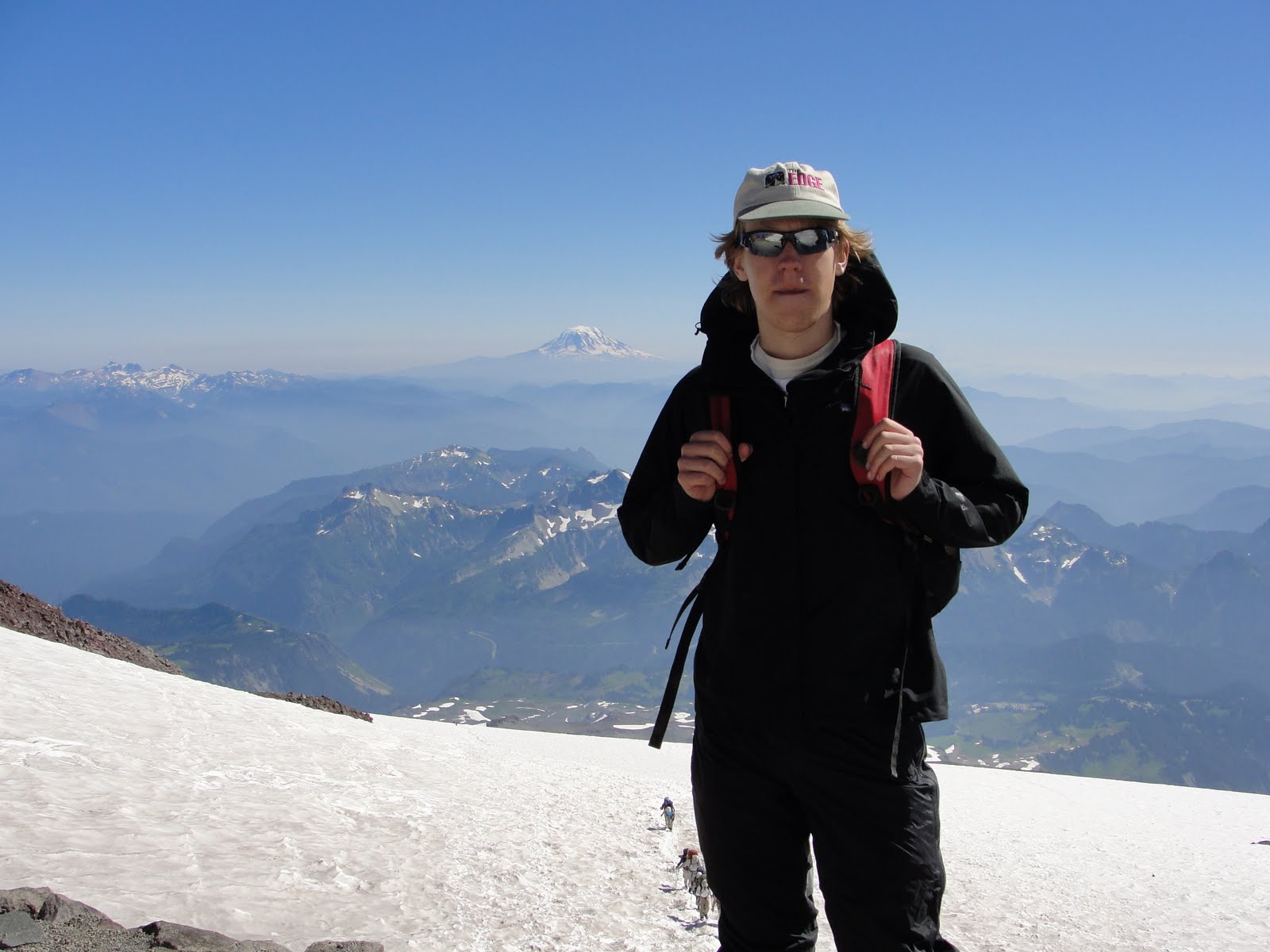
So here I am, chilling at Camp Muir on my lunch break.

Lunch consisted of hamburgers. I made my hamburger into the shape of a cairn, the rock piles used to mark hiking trails!

Here, Cole and I pose with Mt. Adams in the distance. Last year, we stood on the summit of Mt. Adams and got a photo with Mt. Rainier in the background. :-)

The Descent
The descent is a fun part of mountaineering. You spend most of the time being one with the inherent slipperiness of the terrain, either by "skiing" down on your hiking boots, or by glissading (sliding down on your butt).

Cole and I found an excellent glissade at one point. It was super deep. We joked that it was the sort of glissade mountaineers dream about. The sort of glissade that you'll still be talking about over beers a decade from now. The double rainbow starting to look like a TRIPLE RAINBOW of glissading, if you will.

Here is Cole on the super glissade:

Some other amazing glissade trails awaited us further on:


Here is a random photo of the descent. I like it because it's relaxed. If I looked like this while walking away from a huge explosion, I would probably be in a James Bond movie. Click for the full resolution; it's better that way.

When we got off the glaciers again, we took a wrong turn, and came across this photogenic location:

If you look veeeery closely (and perhaps zoom in on the above image), you can see a bridge we drove across on the way to Camp Muir down in the valley on the far right of the above image. I had to slow nearly to a stop on that bridge to admire the view.
We got back on the right trail and made it back to the trailhead. The descent took us about 3 hours. Cole finished it shoeless, because his mountaineering boots were getting too small and giving him blisters. Still, it was an amazing trip. We took 8 hours total, including a little over an hour at Camp Muir and a little detour down a wrong trail. It makes for an excellent day hike.


In the future, Cole and I might attempt to summit Mt. Rainier. The area above Camp Muir looks pretty amazing in photos, full of dramatic glaciers, crevasses, and rock formations. It's a bit too technical for my current climbing level, though, so my next goal is Mt. Hood. Here's a sneak peak of what awaits above Camp Muir...

(photo from troymason's flickr photostream)


(photos from leodirac's flicker photostream)
Kelsey B. has informed me that the purple flowers we saw in the talus are called "skypilot," and that they only grow at high elevation!
ReplyDelete